Local brief
River Flood Warning: Okaloosa County, FL — moderate flooding on the Shoal River near Crestview after Hurricane Isaias
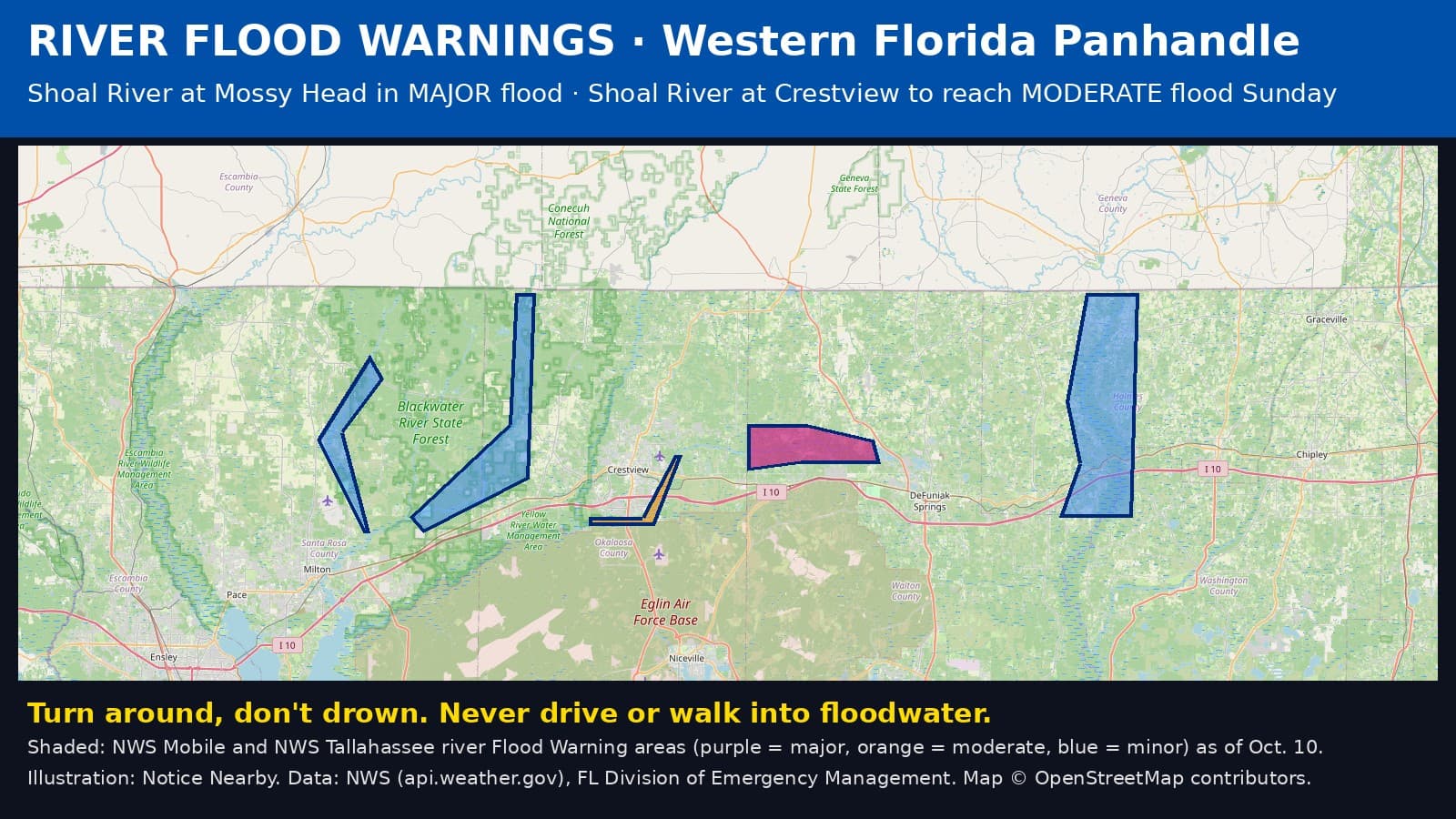
The National Weather Service has a river Flood Warning in Okaloosa County, Florida, for the Shoal River near Crestview and the Blackwater River near Baker and the Big Coldwater Creek near Milton, as rain from Hurricane Isaias drains into area rivers. Stay off flooded roads and away from fast water. Turn around, don't drown.
Florida's Division of Emergency Management said Saturday morning that numerous rivers in the western Panhandle are forecast to reach moderate to major flood stage on Oct. 10 and 11, and that flooding can hide downed power lines, debris and damaged roads (https://x.com/FLSERT/status/2108887405260407273). National Weather Service river Flood Warnings now cover parts of Okaloosa County.
Shoal River near Crestview — in effect until Tuesday evening, Oct. 13. MODERATE flooding forecast. Minor flooding is happening now. The river was at 8.8 feet at 9:15 a.m. CDT Saturday (flood stage 8 feet) and is forecast to crest near 14.9 feet Sunday evening, then fall below flood stage early Tuesday afternoon. At 12 feet, homes on the south bank near Crestview become cut off and Rattlesnake Bluff Road closes; at 13 feet, homes on the south bank begin to flood; at 14 feet, homes in the Trevor Court area flood. NWS warning: https://api.weather.gov/alerts/urn:oid:2.49.0.1.840.0.a519de814aaeac91013b5464bb4e4e66dc5c7cf6.001.1
Blackwater River near Baker — in effect until Monday morning, Oct. 12. Minor flooding forecast. The river was at 8.6 feet at 9 a.m. CDT Saturday and is forecast to rise above its 11-foot flood stage this afternoon and crest near 14.1 feet Sunday morning, then drop below flood stage early Monday. At 9.5 feet, the Kennedy and Peaden bridges upstream of the Highway 4 bridge flood; at 11 feet, secondary roads and low areas below the Highway 4 bridge flood; at 14.5 feet, Cotton Bridge Park in Baker begins to flood. NWS warning: https://api.weather.gov/alerts/urn:oid:2.49.0.1.840.0.c8f9a622f28eb3ca99787c50244dbe3c1c7eaff1.001.1

Big Coldwater Creek near Milton — in effect until Monday evening, Oct. 12. Minor flooding forecast. The creek was at 6.5 feet at 9 a.m. CDT Saturday and is forecast to rise above its 10-foot flood stage this evening and crest near 11.4 feet Sunday morning, flooding low areas and some fish camps. It should fall below flood stage early Monday afternoon. NWS warning: https://api.weather.gov/alerts/urn:oid:2.49.0.1.840.0.2845de757178a58ea3abfb2f80881b6c148d990a.001.1
What to do: never drive or walk into floodwater; 6 inches of moving water can knock you down, and 1 to 2 feet can float a car. Do not drive around barricades. Stay away from riverbanks. If you live near these rivers, move valuables and vehicles to higher ground and be ready to leave if water rises. Report flooded roads to 911 only if someone is in danger.
Sources: National Weather Service Mobile river Flood Warnings via api.weather.gov; FL Division of Emergency Management (https://www.floridadisaster.org/updates). Road conditions: https://fl511.com . Notice Nearby wrote this brief in its own words. More Okaloosa County notices: https://noticenearby.com/fl/okaloosa
Source: the public notice on this register NN-ENV-fl-okaloosa-river-flood-warning-isaias-20 · National Weather Service river Flood Warnings · FL Division of Emergency Management.
This is a Notice Nearby local brief — an in-house explainer written from a government-posted notice on this register. It is not official minutes, not a newspaper story, and not Legal Publication.