Local brief
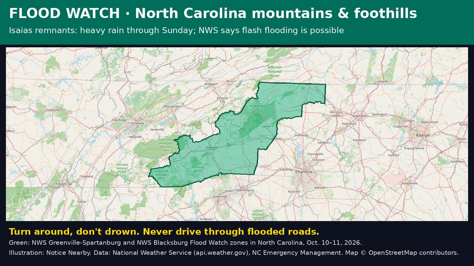
Flood Watch: Surry County, NC — flash flooding possible from Isaias rain until 8 p.m. EDT Sunday, Oct. 11
The National Weather Service has Surry County, North Carolina, under a Flood Watch until 8 p.m. EDT Sunday, Oct. 11 (5 p.m. PDT) as the remnants of Isaias bring heavy rain to the mountains. Creeks can rise fast. Never drive through a flooded road.
NC Emergency Management said Saturday that rain, flash flooding, gusty winds, severe storms and minor coastal flooding are forecast across North Carolina into Sunday, with the heaviest rain in the mountains, where numerous flash floods are likely Saturday and Saturday night (https://x.com/NCEmergency/status/2108959507468505288).
The National Weather Service office in Blacksburg, Va., has a Flood Watch for Surry County until 8 p.m. EDT Sunday, Oct. 11 (5 p.m. PDT). NWS expects 2 to 4 inches of rain along the crest of the Blue Ridge, with more in spots. Creeks and rivers can flood, storm drains can clog with debris, and streets can flood.
What to do: never drive or walk into floodwater. Turn around, don't drown. If you live along a creek or in a valley, know how you would get to higher ground and be ready to move quickly if water rises, especially at night. Keep your phone charged and turn on emergency alerts. Check roads at https://DriveNC.gov before you go.

Sources: National Weather Service Blacksburg Flood Watch via api.weather.gov (https://api.weather.gov/alerts/urn:oid:2.49.0.1.840.0.9ce0b0a84b83ea5683c302544ccef217c6ad95ab.001.1); NC Emergency Management (https://www.readync.gov/Isaias). Notice Nearby wrote this brief in its own words. More Surry County notices: https://noticenearby.com/nc/surry
Source: the public notice on this register NN-ENV-nc-surry-flood-watch-isaias-2026-10-10 · National Weather Service Blacksburg Flood Watch · NC Emergency Management.
This is a Notice Nearby local brief — an in-house explainer written from a government-posted notice on this register. It is not official minutes, not a newspaper story, and not Legal Publication.