Public paper · October 5, 2026 · Weather desk
Flood Warning: NWS Kansas City and St. Louis Track Missouri River Flooding From Napoleon to Hermann, With Moderate Flooding at Glasgow
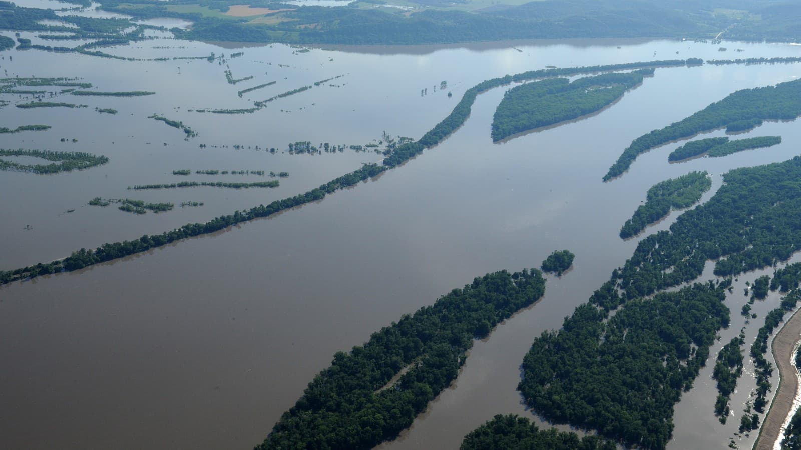
National Weather Service Flood Warnings cover the Missouri River from Napoleon to Hermann, the Grand River near Sumner and Brunswick, and the Mississippi at Louisiana and Clarksville. Glasgow is at moderate flood stage; crests at Jefferson City and Hermann are forecast Monday evening, October 5.
noticenearby.com/papers/nws-flood-warning-missouri-river-glasgow-oct-2026.pdf
National Weather Service offices in Kansas City/Pleasant Hill and St. Louis have Flood Warnings in effect for a string of river forecast points across Missouri after heavy rain upstream. The statements below come from NWS alert updates issued the evening of Sunday, October 4, 2026 (Central Daylight Time). River stages change hour to hour, so check the live NWS hydrograph before you travel.
NWS St. Louis notes that its river forecasts are based on observed precipitation and forecast precipitation for the next 48 hours.
Moderate flooding: Missouri River at Glasgow
- Counties: Chariton, Howard, Saline (MO).
- Stage: 28.3 feet at 7:30 p.m. CDT Sunday; flood stage is 25.0 feet.
- Forecast: falling below flood stage late Monday evening, then to 14.6 feet by Friday evening.
- NWS impacts: at 25 feet farmland along the river floods; at 27 feet many agricultural levees are overtopped, widespread rural flooding occurs, and secondary roads and homes behind levees may be inundated.
Minor flooding: other Missouri River points
- Napoleon (Jackson, Lafayette, Ray): 19.2 ft at 8:00 p.m. Sunday; flood stage 17 ft; falling below flood stage late Monday morning. Low-lying areas unprotected by levees begin to flood at 17 ft.
- Waverly (Carroll, Lafayette, Saline): 24.3 ft at 7:00 p.m. Sunday; flood stage 20 ft; below flood stage Monday evening.
- Miami (Carroll, Chariton, Saline): 23.9 ft at 11:32 a.m. Sunday; flood stage 18 ft; below flood stage Tuesday morning.
- Boonville (Boone, Cooper, Howard, Moniteau): 23.5 ft at 7:04 p.m. Sunday; crest near 23.6 ft just after midnight; flood stage 21 ft. NWS says Easley River Road and Smith Hatchery Road begin to flood at 23.8 ft.
- Jefferson City (Boone, Callaway, Cole, Moniteau): 21.3 ft at 9:45 p.m. Sunday; crest of 23.0 ft forecast Monday evening, right at flood stage. At 24.5 ft the Katy Trail floods near Rocheport.
- Chamois (Callaway, Osage): crest of 18.0 ft forecast early Monday afternoon; flood stage 17 ft; lower-lying bottom land begins to flood.
- Hermann (Gasconade, Montgomery): 19.9 ft at 9:30 p.m. Sunday; crest of 21.1 ft forecast Monday evening; flood stage 21 ft. Minor cropland flooding begins, particularly north of the Highway 19 bridge along the Loutre River.
Grand River and Mississippi River
- Grand River near Sumner: 27.4 ft Sunday evening (flood stage 26 ft); rural roads go under water at 28 ft. Forecast to fall below flood stage just after midnight.
- Grand River near Brunswick: 22.2 ft (flood stage 19 ft); low areas near the U.S. Highway 24 bridge flood.
- Mississippi River at Louisiana: 15.2 ft (flood stage 15 ft); Edison Avenue beyond the railroad tracks begins flooding near this height.
- Mississippi River at Clarksville: 25.2 ft (flood stage 25 ft); the road to Port Marmac, a riverside community of about 13 homes, begins flooding at 25.3 ft.
NWS safety language
The NWS instruction in these warnings: Turn around, don't drown when encountering flooded roads. Most flood deaths occur in vehicles. A Flood Warning means flooding is occurring or imminent at the listed forecast point.
Sources
- National Weather Service active alerts feed (api.weather.gov), Flood Warning updates issued October 4, 2026 by NWS Kansas City/Pleasant Hill MO and NWS St. Louis MO. https://api.weather.gov/alerts/active?area=MO
- NWS St. Louis river information: https://water.noaa.gov/wfo/lsx
- NWS flood safety: http://www.weather.gov/safety/flood
Not legal advice. Not a newspaper. Not Legal Publication. Record of Sale, LLC (Oregon).
Notes and sources
- Author: Ryan Standley / Record of Sale, LLC / Notice Nearby.
- Discussed on @NoticeNearYou: (pending — fill xPostUrl after live post).
- Not legal advice. Not a newspaper. Not Legal Publication. Record of Sale, LLC (Oregon).
Weather desk · Notice Nearby public papers shelf. @NoticeNearYou post pending.
Not legal advice. Not a newspaper. Not Legal Publication. Record of Sale, LLC (Oregon).