Science Desk · NASA · Earth Observatory
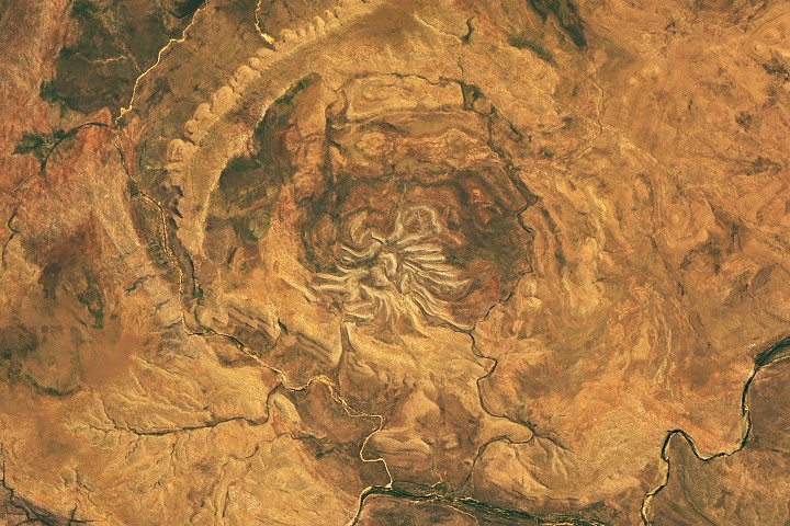
Landsat 9 images Western Australia’s Spider Crater
The eroded impact structure measures about 13 by 11 kilometers; its spider-shaped center is about 4 kilometers across.
Agency release dated 2026-10-13
What the record says
- The OLI instrument on the NASA-USGS Landsat 9 satellite captured the image on Sept. 20, 2026.
- NASA says the full structure is oval, about 13 km by 11 km (8 by 7 miles), with a central portion about 4 km (2.5 miles) across.
- The light-colored “legs” are sandstone ridges left after other rock layers in the impact zone eroded.
- Geologists confirmed the impact origin from shatter cones, fractures that form only when intense shock waves pass through rock.
Source: NASA — An Impact Structure With Legs. Notice Nearby summarized this release; it adds no claims beyond the agency record.