Local brief
Ended: Flood Warning: Styx River near Elsanor + 1 more — Baldwin County, AL (Hurricane Isaias)
Ended early, 7:03 p.m. PT. 2 National Weather Service Flood Warnings were in effect in Baldwin County, Alabama, after Hurricane Isaias's rain: Styx River near Elsanor; Perdido River near Barrineau Park. Turn around, don't drown.
ENDED EARLY: The National Weather Service ended the NWS Flood Warnings for Baldwin County in this brief before its scheduled end (it had been set to run until 6:20 a.m. PT Sun Oct 11); it was no longer active as of 7:03 p.m. PT, Oct. 9, 2026. This brief is kept here as a record. Check https://www.weather.gov for any current alerts.
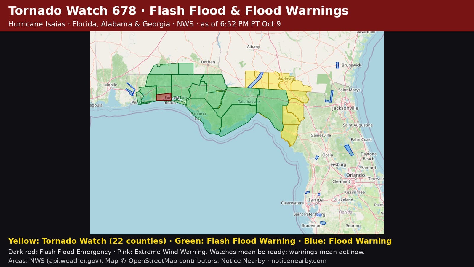
2 river or areal Flood Warnings cover part of Baldwin County, Alabama (NWS, as of 6:52 PM PT, Oct. 9, 2026). These are slower-rising floods than flash floods, but water can stay high for days.
NWS Mobile, Alabama Flood Warning, issued 7:21 a.m. PT Oct. 9: Styx River near Elsanor. Moderate flooding is forecast. When (NWS): From late tonight to Sunday morning. At 7:00 a.m. PT Friday the stage was 2.6 feet. Forecast: The river is expected to rise above flood stage just after midnight tonight to a crest of 15.3 feet early tomorrow afternoon. It will then fall below flood stage early Sunday morning. Flood stage is 12.0 feet. Impacts (NWS): At 12.0 feet, Residents downstream at Seminole Landing should be alert to possible flooding. At 14.0 feet, Moderate Flood Stage. Water reaches top of bulkheads on Donovan Circle in the Seminole Landing community. Upstream, water begins to flood Waterworld and areas near Goat Cooper Roads. At 16.0 feet, Water begins to flood low lying areas on Donovan Circle in the Seminole Landing community. Water begins to overflow bulkheads on Juniper Road. Goat Cooper and Waterworld Rds are flooded with Riverside and the Retreat RV parks flooded. In effect until 6:02 a.m. PT Sun Oct 11. NWS product: https://api.weather.gov/alerts/urn:oid:2.49.0.1.840.0.8b79498148f6ee27be2ca9cc0bf8d6e3ce4aabcb.001.1

NWS Mobile, Alabama Flood Warning, issued 7:17 a.m. PT Oct. 9: Perdido River near Barrineau Park. Minor flooding is forecast. When (NWS): From Saturday afternoon to Sunday morning. At 6:00 a.m. PT Friday the stage was 1.9 feet. Forecast: The river is expected to rise above flood stage tomorrow afternoon to a crest of 13.5 feet tomorrow evening. It will then fall below flood stage early Sunday morning. Flood stage is 13.0 feet. Impacts (NWS): At 12.0 feet, Water begins to flood roadway east of the bridge. At 13.0 feet, River begins to leave its banks at the parking lot of Adventures Perdido River. Begins to threaten several permanently parked travel trailers. Water floods roadway on Florida side of Barrineau Park Bridge. At 14.0 feet, Water begins to flood bridge roadway and Florida side of bridge. In effect until 6:20 a.m. PT Sun Oct 11. NWS product: https://api.weather.gov/alerts/urn:oid:2.49.0.1.840.0.75f46c2d1658ea8091109476237590bc1634e6fb.001.1
Safety, from NWS: "Turn around, don't drown when encountering flooded roads. Most flood deaths occur in vehicles." Move to higher ground if water is rising, never drive or walk into flood water, and be especially cautious at night when it is harder to recognize the dangers of flooding.
Hurricane Isaias, advisory by advisory from the National Hurricane Center: https://noticenearby.com/papers/tropical-storm-isaias-advisory-3-oct-7-2026
Source: National Weather Service Mobile, Alabama Flood Warnings (FLW/FLS) via api.weather.gov; river forecasts: https://water.noaa.gov. Notice Nearby wrote this brief in its own words from NWS; times shown in Pacific time. More Baldwin County notices: https://noticenearby.com/al/baldwin · Alabama hub: https://noticenearby.com/al
Source: the public notice on this register NN-ENV-al-baldwin-flood-warning-isaias-2026-10-0 · National Weather Service Mobile AL Flood Warnings.
This is a Notice Nearby local brief — an in-house explainer written from a government-posted notice on this register. It is not official minutes, not a newspaper story, and not Legal Publication.