Local brief
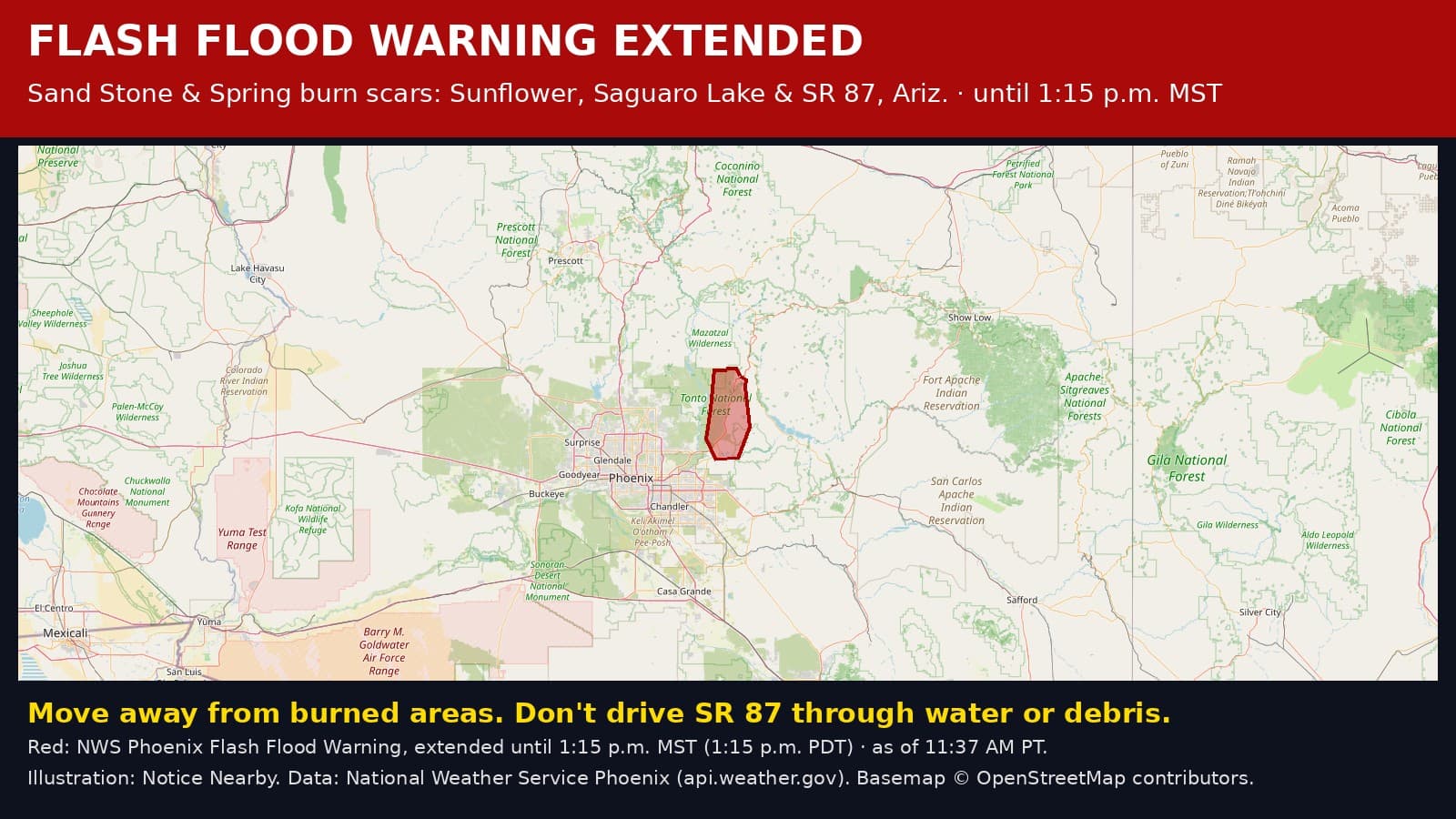
Flash Flood Warning extended: Gila County, AZ — burn scar flooding until 1:15 p.m. MST (1:15 p.m. PDT)
The National Weather Service extended the Flash Flood Warning for the Sand Stone and Spring burn scars in Gila County, Arizona, until 1:15 p.m. MST Sunday, Oct. 11 (1:15 p.m. PDT). Debris flows can cover or wash out roads, including SR 87. Turn around, don't drown.
Extended: At 11:04 a.m. MST Sunday (11:04 a.m. PDT), the National Weather Service in Phoenix extended this Flash Flood Warning until 1:15 p.m. MST (1:15 p.m. PDT). It had been set to end at 11:15 a.m. MST. Radar and rain gauges show 0.75 to 2 inches of rain has fallen over the Sand Stone and Spring burn scars and parts of northeastern Maricopa County, and flash flooding is happening now or will start soon. Arizona does not use daylight time, so MST and PDT show the same clock time today.
What is happening: Thunderstorms are dropping heavy rain on and around the Sand Stone and Spring burn scars, where burned ground cannot soak up water. NWS warns this will cause debris flows of rock, mud and vegetation that can cover or wash out roads. The National Weather Service office in Phoenix says flash flooding is happening now or will start soon. NWS calls this life-threatening flash flooding. Between 0.75 and 2 inches of rain have fallen.
Where: The warning covers the Sand Stone and Spring burn scars in northwestern Gila County, around Sunflower, Round Valley and Sugarloaf Mountain along State Route 87. Places NWS named include Ballantine Trailhead, Round Valley, Sugarloaf Mountain, Sunflower, Sycamore Creek, Saguaro Lake and Salt River Tubing Recreation Area.

Until when: The warning now lasts until 1:15 p.m. MST Sunday, Oct. 11 (1:15 p.m. PDT). NWS can extend it or end it early, so check for updates.
Burn scar danger: NWS says this is a life-threatening situation. Move away from recently burned areas now. Expect rockslides, mudslides and debris flows in steep terrain, and roads and driveways may wash away. Do not drive SR 87 through the warned stretch if water or debris is on the road; if you meet floodwater, climb to safety.
What to do: Turn around, don't drown. Never drive or walk into floodwater. Six inches of moving water can knock you down, and one to two feet can carry away a car. Stay away from creeks, streams, washes, rivers and low roads. Do not drive around barricades. If water starts rising near you, go to higher ground right away. Flooded roads are hard to see in the dark.
Stay informed: Check https://www.weather.gov/psr/ for the latest from the National Weather Service, and follow the Arizona Department of Emergency and Military Affairs (https://dema.az.gov), Gila County Emergency Management and the Tonto National Forest. Turn on emergency alerts on your phone and keep it charged.
Find shelters and supplies: https://zost.app/pages/az/gila
Get prepared: https://noticenearby.com/prepare
Sources: National Weather Service Phoenix Flash Flood Warning via api.weather.gov (https://api.weather.gov/alerts/urn:oid:2.49.0.1.840.0.9d774f9b24a175f2677f920198287948b0876be0.001.1). Updated 11:37 a.m. PDT Sunday, Oct. 11. Notice Nearby wrote this brief in its own words. More Gila County notices: https://noticenearby.com/az/gila
Source: the public notice on this register NN-ENV-az-gila-flash-flood-warning-2026-10-11 · National Weather Service Phoenix Flash Flood Warning.
This is a Notice Nearby local brief — an in-house explainer written from a government-posted notice on this register. It is not official minutes, not a newspaper story, and not Legal Publication.