Local brief
Flood Warning: Walton County in the panhandle of Florida.. + 1 more — Walton County, FL (Hurricane Isaias)
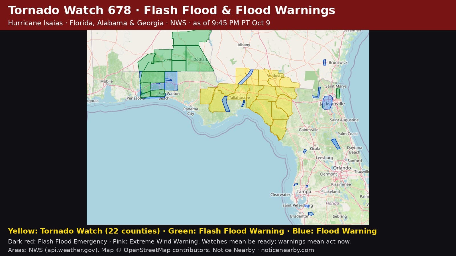
2 National Weather Service Flood Warnings are in effect in Walton County, Florida, after Hurricane Isaias's rain: Walton County in the panhandle of Florida..; Shoal River near Mossy Head (CR 1087). Turn around, don't drown.
2 river or areal Flood Warnings cover part of Walton County, Florida (NWS, as of 9:45 PM PT, Oct. 9, 2026). These are slower-rising floods than flash floods, but water can stay high for days.
NWS Tallahassee, Florida Flood Warning, issued 9:42 p.m. PT Oct. 9: Walton County in the panhandle of Florida... Flooding caused by excessive rainfall is expected. When (NWS): Until 9:45 a.m. PT Saturday. At 9:42 p.m. PT, Doppler radar indicated heavy rain due to thunderstorms. Flooding is ongoing or expected to begin shortly in the warned area. Between 7 and 12 inches of rain have fallen. Some locations that will experience flooding include: De Funiak Springs, Eglin Air Force Base, Union, Liberty, Paxton, Alpine Heights, Oakwood Hills, De Funiak Spring Airport, Cluster Springs, Sand Hill, Pleasant Ridge, Piney Grove, Fox Hill, Mossy Head, New Harmony, Center Ridge, Caney Creek, Glendale, Gordon and New Home. Impacts (NWS): Flooding of rivers, creeks, streams, and other low-lying and flood-prone locations is imminent or occurring. Expect many areas of slow moving or standing water. In effect until 9:45 a.m. PT Sat Oct 10. NWS product: https://api.weather.gov/alerts/urn:oid:2.49.0.1.840.0.f82eb6e0c459f907dfe89cd1dcdd66a65c279902.001.1
NWS Tallahassee, Florida Flood Warning, updated 7:58 p.m. PT Oct. 9: Shoal River near Mossy Head (CR 1087). Moderate flooding is forecast. When (NWS): Until Sunday afternoon. At 7:15 p.m. PT Friday the stage was 11.7 feet. Forecast: The river is expected to rise above flood stage late this evening to a crest of 19.9 feet early tomorrow afternoon. It will then fall below flood stage early Sunday morning. Flood stage is 14.0 feet. Impacts (NWS): At 20.0 feet, Numerous residences along Planation Lane are flooded at this level. In effect until 3:56 p.m. PT Sun Oct 11. NWS product: https://api.weather.gov/alerts/urn:oid:2.49.0.1.840.0.e9fb8b719f8a45e3cc2693f4acd72c4343fc5c09.001.1

Safety, from NWS: "Turn around, don't drown when encountering flooded roads. Most flood deaths occur in vehicles." Move to higher ground if water is rising, never drive or walk into flood water, and be especially cautious at night when it is harder to recognize the dangers of flooding.
Hurricane Isaias, advisory by advisory from the National Hurricane Center: https://noticenearby.com/papers/tropical-storm-isaias-advisory-3-oct-7-2026
Source: National Weather Service Tallahassee, Florida Flood Warnings (FLW/FLS) via api.weather.gov; river forecasts: https://water.noaa.gov. Notice Nearby wrote this brief in its own words from NWS; times shown in Pacific time. More Walton County notices: https://noticenearby.com/fl/walton · Florida hub: https://noticenearby.com/fl
Source: the public notice on this register NN-ENV-fl-walton-flood-warning-isaias-2026-10-09 · National Weather Service Tallahassee FL Flood Warnings.
This is a Notice Nearby local brief — an in-house explainer written from a government-posted notice on this register. It is not official minutes, not a newspaper story, and not Legal Publication.