Local brief
Ended: Flash Flood Warning for Pecos and Brewster counties, TX — Fort Stockton, expired 3:45 a.m. CDT Wednesday
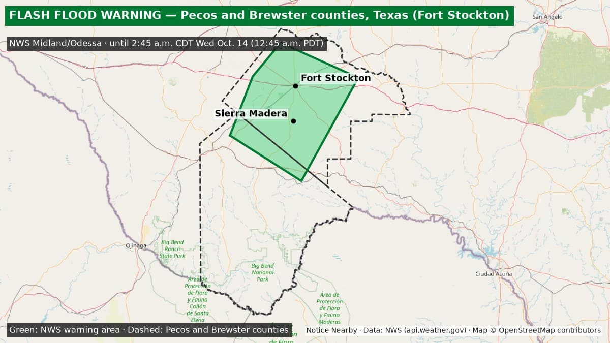
The National Weather Service Midland/Odessa Flash Flood Warning for central Pecos and north-central Brewster counties in West Texas, including Fort Stockton, expired at 3:45 a.m. CDT Wednesday, Oct. 14 (1:45 a.m. PDT).
Ended: The Flash Flood Warning for central Pecos and north-central Brewster counties, including Fort Stockton (NWS Midland/Odessa FF.W.0230), expired at 3:45 a.m. CDT Wednesday, Oct. 14 (1:45 a.m. PDT). In its last update at 3:19 a.m. CDT, NWS kept the end time at 3:45 a.m.; the warning was not extended again and is no longer on the active NWS alert list (checked 1:50 a.m. PDT Wednesday, Oct. 14). The details below are kept for the record. Source: https://api.weather.gov/alerts/active?area=TX.
Essentials: Flash Flood Warning from the National Weather Service in Midland/Odessa for north-central Brewster County and central Pecos County, Texas. Extended at 2:36 a.m. CDT Wednesday, Oct. 14 (12:36 a.m. PDT). Now in effect until 3:45 a.m. CDT Wednesday (1:45 a.m. PDT); it had been set to end at 2:45 a.m. CDT. NWS says flash flooding is ongoing or expected to begin shortly and describes it as life-threatening.
Get prepared: https://noticenearby.com/prepare

What is happening: At 2:36 a.m. CDT, Doppler radar showed thunderstorms producing heavy rain across the warned area. NWS says 1.5 to 2.5 inches of rain have fallen, and up to 1 more inch is possible. NWS rates the flash flood damage threat as considerable. Life-threatening flash flooding of creeks and streams, urban areas, highways, streets and underpasses is possible.
Places named by NWS: Fort Stockton, Sierra Madera, Fort Stockton-Pecos County Airport and Firestone Test Track.
What to do: Turn around, don't drown. Most flood deaths happen in vehicles. NWS says to be especially careful at night, when flooding is harder to see. Do not drive into flooded roads; find another route. NWS also says to stay alert for flooding even where it is not raining, because arroyos, streams and rivers can turn into dangerous currents within minutes from rain falling farther away.
Until when: 3:45 a.m. CDT Wednesday, Oct. 14 (1:45 a.m. PDT). A separate NWS Flash Flood Warning covers northwestern Brewster and east-central Presidio counties, including Alpine, until 5:30 a.m. CDT: https://noticenearby.com/briefs/tx-brewster-alpine-flash-flood-warning-2026-10-14. NWS can extend or cancel early; check https://www.weather.gov/maf/ for updates.
Sources: National Weather Service Midland/Odessa Flash Flood Warning extension via api.weather.gov (https://api.weather.gov/alerts/urn:oid:2.49.0.1.840.0.819e52988466f99764c7e1249b214577249fa21d.001.1). Verified on the active NWS alert list at 12:53 a.m. PDT Wednesday, Oct. 14. Notice Nearby wrote this brief in its own words. More Pecos County notices: https://noticenearby.com/tx/pecos
Source: the public notice on this register NN-NWS-20261013-KMAF-FF-W-0230 · National Weather Service Midland/Odessa TX.
This is a Notice Nearby local brief — an in-house explainer written from a government-posted notice on this register. It is not official minutes, not a newspaper story, and not Legal Publication.